Georeferencing the Early Modern London Book Trade: 3. What’s in an Imprint?
In my previous blog post, I proposed a model TEI-XML tree for encoding and geocoding bibliographic datasets.
In the conclusion of that piece, I suggested that, in order to implement such a model,
print historians must pool their resources and expertise through collaborative data
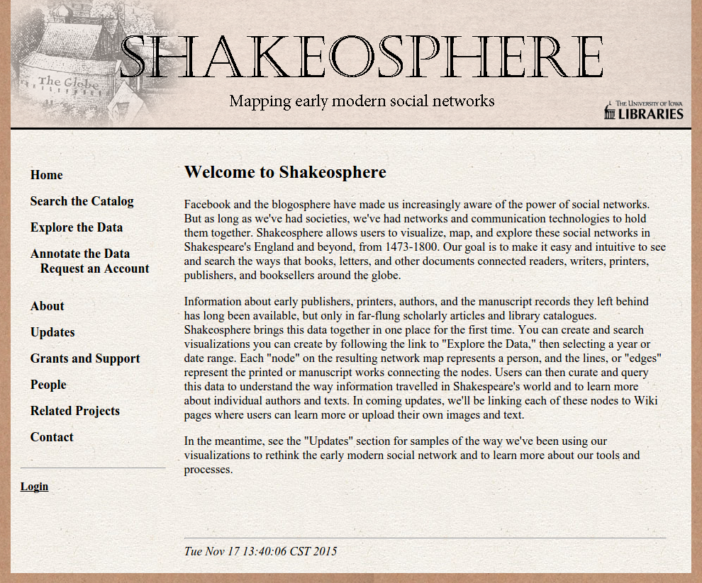
mining and sharing. Over the past year (2014-2015), Janelle Jenstad and I have been working with David Eichmann and Blaine Greteman of the University of Iowa to extract precise geographic data points from the English Short Title Catalogue (ESTC). Dr. Eichmann and Dr. Greteman have developed some groundbreaking methods to datamine
the ESTC as part of the Shakeosphere project, which enables researchers and students
to search, analyze, and contribute to a visualization of the early modern print and manuscript network.As I suggested in my first blog post, print historians have hitherto been unable to extract meaningful geographic data points from the ESTC because book imprints (data field
260 in MARC-tagged database entries) remain unparsed. Record number 006182591 served as my former example:
Note that field260 |a London : |b Printed by Thomas Creede, for Tho. Millington, and Iohn Busby. And are to be sold at his house in Carter Lane, next the Powle head, |c 1600.
(ESTC 006182591)
260|b contains the printer’s name, the booksellers’ names, and the bookshop location, each
undemarcated. To surmount this technical barrier and realize the full potential of
ESTC data, David Eichmann has developed a name-entity recognition algorithm that recognizes
and parses the various data points contained within field 260|b of ESTC entries based on linguistic patterns. Dr. Eichmann’s algorithm parses an entry and
wraps custom tags around the individual pieces of information in the imprint. For
example, his algorithm transforms record number 006182591 into the following XML code:
<location>London</location> : Printed by <stationer><forename>Thomas</forename> Creede</stationer>, for <stationer>Tho. Millington</stationer>, and <stationer>Iohn Busby</stationer>. And are to be sold <locational>at</locational> <location>his house</location> <locational>in</locational> <location>Carter Lane</location>, <locational>next</locational> <location>the Powle head</location>, <date>1600</date>.
From this initial mark-up, it becomes apparent that book imprints, though pointing
to one location of print activity (i.e., a single set of supposed geo-coordinates),
contain multiple toponyms. Each toponym expresses a different level of spatial precision
(e.g.,
his houseis more precise than
Carter Lane). Moreover, the spatial hierarchies between toponyms are expressed by way of locational prepositions. Insofar as geography may be described as the
depiction or analysis of the way the constituent parts of something interact, or of their arrangement in relation to one another(OED geography n.5), the
geography of the bookemerges from the intersection of relations between toponyms and names associated with a book, expressed in a book imprint.
Dr. Eichmann has been kind enough to share his parsed imprint data with Dr. Jenstad and me. Using XSLT, I was able to transform his data into a set of five TEI-XML databases:
-
A
<listBibl>database of sources (i.e., ESTC entries), each identified by its Shakeosphere ID number and date. -
A
<listPers>database of identified stationers, containing each stationer’s forename, surname, and floruit dates. -
A
<listPlace>database of identified locations, containing the various toponyms used to refer to each location across imprints. -
A
<listRelation>database of relations between identified locations, expressed by locational prepositions. -
A
<listRelation>database of relations between identified stationers and identified locations expressed by locational prepositions.
I would like to suggest that the fifth and final database, which cross-references
data contained in the other databases, holds enormous potential for early modern print
historians interested in the geography of the book. As I mentioned in my first blog
post, in order to interact meaningfully with the burgeoning field of geohumanities,
print historians need to be able to make large-scale queries about
locations of print activity.What is meant by this term is a matter of precision: a location of print activity may be a continent, a country, a county, a city, a ward, a street, or a building. For some print historians, it may suffice to georeference data according to broader categories such as country or city; however, for print historians interested in the early modern London booktrade, high precision is critically important. The ESTC, for example, contains almost 66,000 entries of books published in London between 1475 and 1666. By situating stationers in relation to locations, the fifth database enables print historians to make queries about individual stalls, stands, and shops occupied by individual stationers in London. Consider the following entries taken from the prototype database:
<relation name="in" active="16665" passive="8762" notBefore-custom="1624" notAfter-custom="1679" datingMethod="mol:julian" source="109143; 141029; 149836; 154172; 165144; 165554"></relation>
<relation name="at" active="14575" passive="7562" notBefore-custom="1633" notAfter-custom="1641" datingMethod="mol:julian" source="89376; 188336"></relation>
This first XML element essentially states that, according to Shakeosphere entries
109143 141029, etc., stationer 16665 in the <listPers> database (i.e., Francis Coles) worked inlocation
1624 in the <listPlace> database (i.e., Vine Street) from 1624 to 1679. From this relationwe can infer a location of print activity, namely
Francis Cole’s Shop in Vine Street.Further research would then be required to match this qualitative description of a place with the quantitative coordinates of its geographic space, for example, on the Agas map or another georeferenced surface.
The second XML element similarly suggests that, according to Shakeosphere entries
89376 and 188336, stationer 14575 in the <listPers> database (i.e., John Rothwell) worked atlocation
7562 in the <listPlace> database (i.e.,The Sun) from 1633 to 1641. From this relationwe can infer a location of print activity, namely
John Rothwell’s Shop at the Sign of the Sun,or simply
The Sign of the Sun.Because there were many places in early modern London demarcated by the sign of the sun, one would need to consult the fourth database, which contains relations among location identities, to determine that this
sign of the Sunwas located in St. Paul’s Churchyard. Further research could then determine the spatial coordinates that correlated with this qualitative description of a place.
A wealth of information is embedded in the syntax of book imprints. My research suggests that, in its simplest form, a book imprint expresses three data
points in prose: (1) a stationer, (2) a toponym referring to a location of print activity,
and (3) a preposition describing the relationship between 1 and 2.1 However, until recently, the resources (i.e., software, knowhow, funding, etc.) required
to retrieve and cross-reference these three data points has not been available to
print historians. Collaboration has provided Dr. Jenstad and me with an innovative and effective way to transcend this barrier. Working with
the Shakeosphere team in Iowa, we have successfully developed prototype methods for parsing the relational
data contained in early modern book imprints.
Notes
- Further research might consider the way that different prepositions signify different geographic relationships. Based on my rudimentary work in this area, I believe that it may be possible to develop a taxonomy of prepositions used in book imprints, describing the different types of relationships stationers had with locations of print activity. (TLG)↑
References
-
Citation
English Short Title Catalogue. British Library. Subscription.This item is cited in the following documents:
-
Citation
Oxford English Dictionary. Oxford: Oxford UP, 2012. Subscription. OED.This item is cited in the following documents:
-
Citation
Shakeosphere: Mapping Early Modern Social Networks. Created by Blaine Greteman and David Eichmann. Iowa City: University of Iowa Libraries. Open.This item is cited in the following documents:
Cite this page
MLA citation
.
Georeferencing the Early Modern London Book Trade: 3. What’s in an Imprint?The Map of Early Modern London, edited by , U of Victoria, 20 Jun. 2018, mapoflondon.uvic.ca/BLOG18.htm.
Chicago citation
.
Georeferencing the Early Modern London Book Trade: 3. What’s in an Imprint?The Map of Early Modern London. Ed. . Victoria: University of Victoria. Accessed June 20, 2018. http://mapoflondon.uvic.ca/BLOG18.htm.
APA citation
2018. Georeferencing the Early Modern London Book Trade: 3. What’s in an Imprint?
In (Ed), The Map of Early Modern London. Victoria: University of Victoria. Retrieved from http://mapoflondon.uvic.ca/BLOG18.htm.
RIS file (for RefMan, EndNote etc.)
Provider: University of Victoria
Database: The Map of Early Modern London
Content: text/plain; charset="utf-8"

TY  - ELEC
A1  - Landels-Gruenewald, Tye
ED  - Jenstad, Janelle
T1  - Georeferencing the Early Modern London Book Trade: 3. What’s in an Imprint?
T2  - The Map of Early Modern London
PY  - 2018
DA  - 2018/06/20
CY  - Victoria
PB  - University of Victoria
LA  - English
UR  - http://mapoflondon.uvic.ca/BLOG18.htm
UR  - http://mapoflondon.uvic.ca/xml/standalone/BLOG18.xml
ER  -
RefWorks
RT Web Page
SR Electronic(1)
A1 Landels-Gruenewald, Tye
A6 Jenstad, Janelle
T1 Georeferencing the Early Modern London Book Trade: 3. What’s in an Imprint?
T2 The Map of Early Modern London
WP 2018
FD 2018/06/20
RD 2018/06/20
PP Victoria
PB University of Victoria
LA English
OL English
LK http://mapoflondon.uvic.ca/BLOG18.htm
TEI citation
<bibl type="mla"><author><name ref="#LAND2"><surname>Landels-Gruenewald</surname>, <forename>Tye</forename></name></author>. <title level="a">Georeferencing the Early Modern London Book Trade: 3. What’s in an Imprint?</title> <title level="m">The Map of Early Modern London</title>, edited by <editor><name ref="#JENS1"><forename>Janelle</forename> <surname>Jenstad</surname></name></editor>, <publisher>U of Victoria</publisher>, <date when="2018-06-20">20 Jun. 2018</date>, <ref target="http://mapoflondon.uvic.ca/BLOG18.htm">mapoflondon.uvic.ca/BLOG18.htm</ref>.</bibl>Personography
-
Blaine Greteman
BG
Blaine Greteman is an associate professor of English at the University of Iowa, specializing in early modern literature, digital humanities, and nonfiction. In 2013 he published The Poetics and Politics of Youth in the Age of Milton, and he writes regularly for popular publications, including The New Republic.Roles played in the project
-
Vetter
Blaine Greteman is mentioned in the following documents:
-
-
Janelle Jenstad
JJ
Janelle Jenstad, associate professor in the department of English at the University of Victoria, is the general editor and coordinator of The Map of Early Modern London. She is also the assistant coordinating editor of Internet Shakespeare Editions. She has taught at Queen’s University, the Summer Academy at the Stratford Festival, the University of Windsor, and the University of Victoria. Her articles have appeared in the Journal of Medieval and Early Modern Studies, Early Modern Literary Studies, Elizabethan Theatre, Shakespeare Bulletin: A Journal of Performance Criticism, and The Silver Society Journal. Her book chapters have appeared (or will appear) in Performing Maternity in Early Modern England (Ashgate, 2007), Approaches to Teaching Othello (Modern Language Association, 2005), Shakespeare, Language and the Stage, The Fifth Wall: Approaches to Shakespeare from Criticism, Performance and Theatre Studies (Arden/Thomson Learning, 2005), Institutional Culture in Early Modern Society (Brill, 2004), New Directions in the Geohumanities: Art, Text, and History at the Edge of Place (Routledge, 2011), and Teaching Early Modern English Literature from the Archives (MLA, forthcoming). She is currently working on an edition of The Merchant of Venice for ISE and Broadview P. She lectures regularly on London studies, digital humanities, and on Shakespeare in performance.Roles played in the project
-
Author
-
Author of Abstract
-
Author of Stub
-
Author of Term Descriptions
-
Author of Textual Introduction
-
Compiler
-
Conceptor
-
Copy Editor
-
Course Instructor
-
Course Supervisor
-
Course supervisor
-
Data Manager
-
Editor
-
Encoder
-
Encoder (Structure and Toponyms)
-
Final Markup Editor
-
GIS Specialist
-
Geographic Information Specialist
-
Geographic Information Specialist (Modern)
-
Geographical Information Specialist
-
JCURA Co-Supervisor
-
Main Transcriber
-
Markup Editor
-
Metadata Co-Architect
-
MoEML Transcriber
-
Name Encoder
-
Peer Reviewer
-
Primary Author
-
Project Director
-
Proofreader
-
Researcher
-
Reviser
-
Second Author
-
Second Encoder
-
Toponymist
-
Transcriber
-
Transcription Proofreader
-
Vetter
Contributions by this author
Janelle Jenstad is a member of the following organizations and/or groups:
Janelle Jenstad is mentioned in the following documents:
-
-
Tye Landels-Gruenewald
TLG
Research assistant, 2013-15, and data manager, 2015 to present. Tye completed his undergraduate honours degree in English at the University of Victoria in 2015.Roles played in the project
-
Author
-
Author of Term Descriptions
-
CSS Editor
-
Compiler
-
Conceptor
-
Copy Editor
-
Data Manager
-
Editor
-
Encoder
-
Geographic Information Specialist
-
Markup Editor
-
Metadata Architect
-
MoEML Researcher
-
Name Encoder
-
Proofreader
-
Researcher
-
Toponymist
-
Transcriber
Contributions by this author
Tye Landels-Gruenewald is a member of the following organizations and/or groups:
Tye Landels-Gruenewald is mentioned in the following documents:
-
-
Kim McLean-Fiander
KMF
Director of Pedagogy and Outreach, 2015–present; Associate Project Director, 2015–present; Assistant Project Director, 2013-2014; MoEML Research Fellow, 2013. Kim McLean-Fiander comes to The Map of Early Modern London from the Cultures of Knowledge digital humanities project at the University of Oxford, where she was the editor of Early Modern Letters Online, an open-access union catalogue and editorial interface for correspondence from the sixteenth to eighteenth centuries. She is currently Co-Director of a sister project to EMLO called Women’s Early Modern Letters Online (WEMLO). In the past, she held an internship with the curator of manuscripts at the Folger Shakespeare Library, completed a doctorate at Oxford on paratext and early modern women writers, and worked a number of years for the Bodleian Libraries and as a freelance editor. She has a passion for rare books and manuscripts as social and material artifacts, and is interested in the development of digital resources that will improve access to these materials while ensuring their ongoing preservation and conservation. An avid traveler, Kim has always loved both London and maps, and so is particularly delighted to be able to bring her early modern scholarly expertise to bear on the MoEML project.Roles played in the project
-
Associate Project Director
-
Author
-
Author of MoEML Introduction
-
CSS Editor
-
Compiler
-
Contributor
-
Copy Editor
-
Data Contributor
-
Data Manager
-
Director of Pedagogy and Outreach
-
Editor
-
Encoder
-
Encoder (People)
-
Geographic Information Specialist
-
JCURA Co-Supervisor
-
Managing Editor
-
Markup Editor
-
Metadata Architect
-
Metadata Co-Architect
-
MoEML Research Fellow
-
MoEML Transcriber
-
Proofreader
-
Researcher
-
Second Author
-
Secondary Author
-
Secondary Editor
-
Toponymist
-
Vetter
Contributions by this author
Kim McLean-Fiander is a member of the following organizations and/or groups:
Kim McLean-Fiander is mentioned in the following documents:
-
-
Joey Takeda
JT
Programmer, 2018-present; Junior Programmer, 2015 to 2017; Research Assistant, 2014 to 2017. Joey Takeda is an MA student at the University of British Columbia in the Department of English (Science and Technology research stream). He completed his BA honours in English (with a minor in Women’s Studies) at the University of Victoria in 2016. His primary research interests include diasporic and indigenous Canadian and American literature, critical theory, cultural studies, and the digital humanities.Roles played in the project
-
Author
-
Author of Abstract
-
Author of Stub
-
CSS Editor
-
Compiler
-
Conceptor
-
Copy Editor
-
Data Manager
-
Date Encoder
-
Editor
-
Encoder
-
Encoder (Bibliography)
-
Geographic Information Specialist
-
Geographic Information Specialist (Agas)
-
Junior Programmer
-
Markup Editor
-
Metadata Co-Architect
-
MoEML Encoder
-
MoEML Transcriber
-
Programmer
-
Proofreader
-
Researcher
-
Second Author
-
Toponymist
-
Transcriber
-
Transcription Editor
Contributions by this author
Joey Takeda is a member of the following organizations and/or groups:
Joey Takeda is mentioned in the following documents:
-
-
Katie Tanigawa
KT
Katie Tanigawa is a doctoral candidate at the University of Victoria. Her dissertation focuses on representations of poverty in Irish modernist literature. Her additional research interests include geospatial analyses of modernist texts and digital humanities approaches to teaching and analyzing literature.Roles played in the project
-
Author
-
Conceptor
-
Encoder
-
GIS
-
Managing Editor
-
Markup Editor
-
Name Encoder
-
Project Manager
-
Proofreader
-
Researcher
-
Second Author
-
Transcription Proofreader
Contributions by this author
Katie Tanigawa is a member of the following organizations and/or groups:
Katie Tanigawa is mentioned in the following documents:
-
-
Martin D. Holmes
MDH
Programmer at the University of Victoria Humanities Computing and Media Centre (HCMC). Martin ported the MOL project from its original PHP incarnation to a pure eXist database implementation in the fall of 2011. Since then, he has been lead programmer on the project and has also been responsible for maintaining the project schemas. He was a co-applicant on MoEML’s 2012 SSHRC Insight Grant.Roles played in the project
-
Author
-
Author of abstract
-
Conceptor
-
Encoder
-
Name Encoder
-
Post-conversion and Markup Editor
-
Programmer
-
Proofreader
-
Researcher
Contributions by this author
Martin D. Holmes is a member of the following organizations and/or groups:
Martin D. Holmes is mentioned in the following documents:
-
-
Francis Coles is mentioned in the following documents:
-
John Rothwell is mentioned in the following documents:
Locations
-
Vine Street is mentioned in the following documents:
-
Francis Cole’s Shop in Vine Street is mentioned in the following documents:
-
The Sun is mentioned in the following documents:
-
St. Paul’s Churchyard is mentioned in the following documents:
