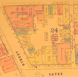
1885 Fire Insurance Plans of Victoria
 In 1885 the Sandborn Map & Publishing Company of New York published an atlas of
fire insurance plans of Victoria. The plans were printed on 13 large sheets, with a scale
of 50 feet to the inch (relative scale 1:600). The plans represent city streets and buildings
in extraordinary detail.
The original plans are held in the Rare Books and Special Collections Division of The University of British Columbia Library [accession G3513/V5/G475/1885/S2] and are reproduced here with permission of the Library.
The plans were photographed in situ by Chris Dykstra, a History student at the University of Victoria. He created high resolution, digital images of the plans and formatted the images for the web. He also created a sequence of inter-related pages, which simulate the original fire insurance atlas.
Ryan Sutton, a student research assistant at the Centre for Digital Humanities Innovation at Malaspina University-College, added an innovative and intuitive navigation system to the web pages.