Colonial Despatches
The colonial despatches of Vancouver Island and British Columbia 1846-1871
Map of part of Vancouver Island, the Gulf of Georgia and supposed Strait of Juan de Fuca
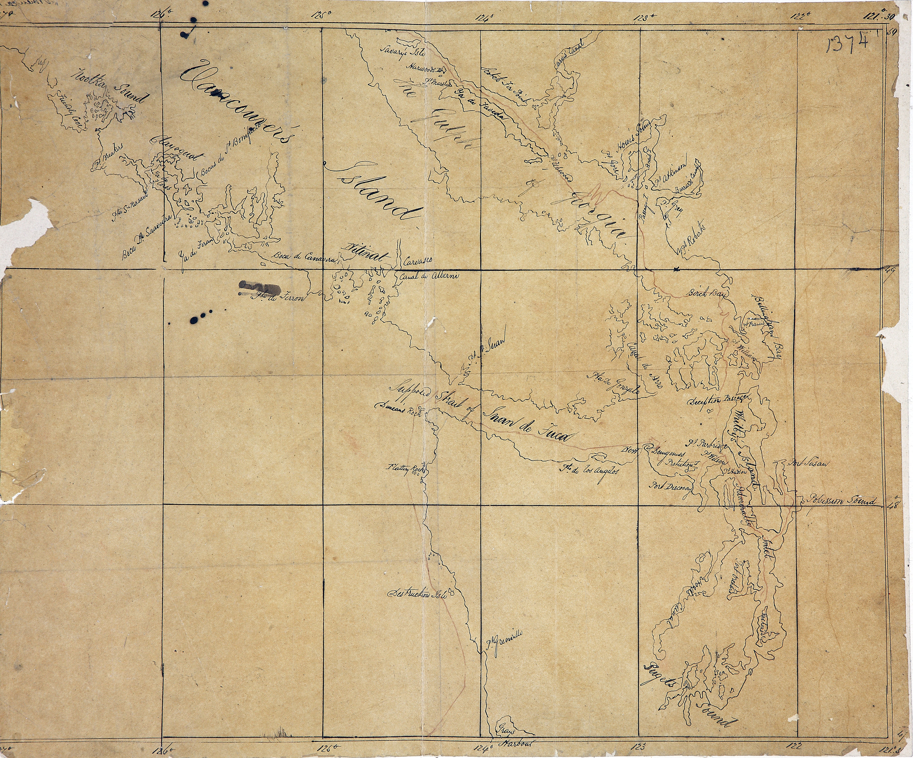
Map of part of Vancouver Island, the Gulf of Georgia and supposed Strait of Juan de
Fuca. Original. 13.33 sea miles to an inch. In Mr Bancroft's letter of 3 Nov 1848.
[Vancouver Island, 1848]. Title supplied by cataloguer.
Map of part of Vancouver Island, the Gulf of Georgia and supposed Strait of Juan de
Fuca, 1848, National Archives of the UK, FO 925/1374. The Colonial Despatches of Vancouver Island and British Columbia 1846-1871, Edition 2.6, ed. James Hendrickson and the Colonial Despatches project. Victoria,
B.C.: University of Victoria. https://bcgenesis.uvic.ca/fo_925-1374_van_isl_1848.html.
Title: Map of part of Vancouver Island, the Gulf of Georgia and supposed Strait of Juan de Fuca
Title: Vancouver Island
Subject: Vancouver Island (B.C.)--Maps; Georgia, Gulf of (B.C. and Wash.)--Maps; Juan de Fuca Strait (B.C. and Wash.)--Maps
Subject: Vancouver Island, 1848
Identifier (repository): FO
Identifier (repoNumber): 925
Identifier (repoVol): 1374
Identifier (libFileName): FO925-1374
Identifier (penfoldNum): 558
Identifier (doc_id): FO 925/1374
Date: 1848
Funder: Funded by a Canadian Council of Archives, Archival Community Digitization Program.
Publisher: National Archives of the UK.
50 00'N--47 00'N / 127 00'W--121 00'W